Challenge
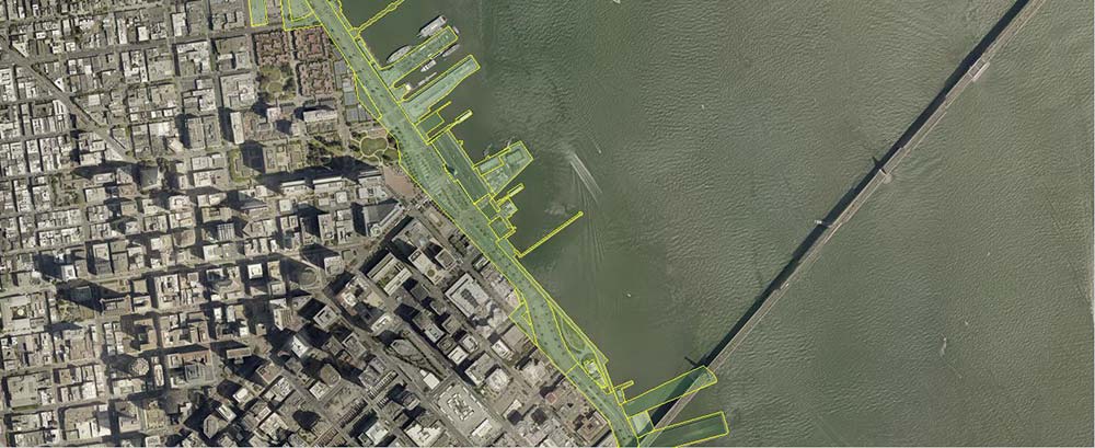
The Port of San Francisco owns a myriad of facilities along the City’s embarcadero. Those facilities include piers, marinas, and a significant leased commercial, retail, and residential space. The Port needed a digital mappings system to get a better handle on what facilities it owns, who is responsible for maintenance and a strategy for providing emergency services to users of Port facilities.
Solution
Farallon conducted needs analysis interviews with key Port staff and developed a plan to iteratively migrate away from managing spatial data as graphics and CAD files and toward use of a modern, scalable GIS technology.
Based on this plan Farallon compiled available source data it into a single, consistent, geographically referenced spatial database that could be easily maintained and expanded by Port staff.
To take advantage of the Port’s existing investment in Autodesk software and expertise, Farallon implemented the solution and maintentance/update workflows using ESRI and AutoCAD Map.
Farallon’s solution now enables Port staff to maintain digital mapping data for key its facilities, and provides a solid platform for integration of its spatial data with key business systems such as Computer Aided Dispatch and Enterprise Asset Management.
Screenshots & Videos