Farallon is hard at work with the Getty Conservation Institute and the World Monuments Fund on Version 4 of Arches, an open-source geospatially enabled information system designed to inventory and manage all types of immovable heritage, including archaeological sites, buildings, structures, landscapes, and heritage ensembles or districts.
Farallon customizes Arches to manage just about any type of data from cultural resources and cultural heritage to projects for environmental, agricultural, natural resources, utility system networks, water treatment plants and transportation infrastructure (see “Arches Asset Management Framework Handles More than Just Cultural Heritage“).
The new features planned for Arches Version 4.0 (planned for completion by Fall 2016) include:
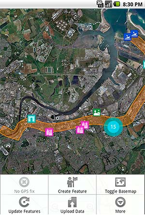
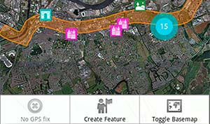
- Mobile data collection (smartphone/tablet field data collection with or without network connectivity)
- Data contributions including crowdsourcing with data-collection project manager tool
- Installation wizard and application configuration manager to simply installations and needed dependencies
- Graph manager (easily create, edit and share graphs within Arches)
- User-profile, permissions manager
- Tile server for satellite and other imagery
- Improved data-entry forms
- Priority assessment module
- JSON data import/export
- Arches API and technology upgrades
Update Sep 28, 2016: Learn more about Resource Graphs in Arches v4 and Custom Widgets and Custom Data Types in Arches 4.