 I am consistently amazed by the quality of the GPS chipsets present in average smartphones and tablets. Typically these devices give location readings with accuracies of 10 of meters, although under ideal conditions I have seen several Android phones report an accuracy of 2 meters! This is pretty impressive considering that these devices do so much beyond just GPS.
Still it is a fair question to ask, “Can a consumer based smartphone really meet the demands of my organization’s spatial problem? Don’t we need a more accurate, professional grade device with a high accuracy GPS receiver?”. The answer to this really depends on how you intend to apply the spatial data. It’s the same question (and answer) that GIS practitioners have been arguing with surveyors about for decades: The higher the level of spatial accuracy you need, the higher your equipment costs are going to be. Thus it is very important to avoid the pitfall of imposing arbitrary data accuracy requirements on a project just because the numbers sound good, and not because they provide any greater business value. Ask yourself; Do you truly need the gold-plated solution to meet your business objective?
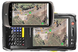
Even if you do really need higher spatial accuracy than a standard smartphone or tablet can provide (say for an engineering design project) there are still options for leveraging the user experience provided by modern smartphones and tablets. Recently I worked on a project where the client required 2-5 meter accuracy on the spatial data they were collecting. Fortunately there are several professional grade GPS devices that now run the Android operating system, including the Trimble Nomad. Using these devices allowed us to leverage the Android user interface to create a fast and easy to use application while still meeting the enhanced spatial accuracy requirements of the client.
So what if you need really need survey grade spatial accuracy. Fortunately, there are survey grade GPS receivers like the Trimble Rover which provide a bluetooth interface. Using bluetooth we can create applications that run on a standard smartphone or tablet, but leverage a survey grade GPS sensor on another specialized device. This allows us to take advantage of the benefits provided by modern smartphones and tablets like form factor and intuitive user interfaces, while still meeting the spatial accuracy requirements a project may impose.